Geolocate

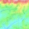
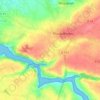
Brasparts topographic map

Click on the map to display elevation.

About this map

Name: Brasparts topographic map, elevation, terrain.

Location: Brasparts, Châteaulin, Finistère, Brittany, Metropolitan France, 29190, France (48.27458 -4.01126 48.36235 -3.89445)

Average elevation: 564 ft

Minimum elevation: 128 ft

Maximum elevation: 1,240 ft

Other topographic maps

Click on a map to view its topography, its elevation and its terrain.
Kerfany-les-Pins

France > Brittany > Finistère > Moëlan-sur-Mer

Average elevation: 56 ft

Ar Vodennic

France > Brittany > Finistère > Plomodiern

Average elevation: 220 ft

Garret

France > Brittany > Finistère > Menfig

Average elevation: 23 ft

Pors Elenec

France > Brittany > Finistère > Roscoff

Average elevation: 23 ft

Stêr an Ale

France > Brittany > Finistère > Plomodiern

Average elevation: 312 ft

Espace du Kelenn

France > Brittany > Finistère > Carantec

Average elevation: 30 ft

Park Mar

France > Brittany > Finistère > Scaër

Average elevation: 436 ft

Kergonvel

France > Brittany > Finistère > Plouguerneau

Average elevation: 121 ft

Gear up for your next adventure:

🧢Outdoor Hiking Hat - Sun protection hat for outdoor explorers
🔌USB Car Charger - Car charger for on‑the‑go power needs
🌡️Portable Weather Meter - Track weather conditions on the trail
🗺️NatGeo Topo Maps - High-quality waterproof printed topographic maps of US Parks
🪶Paracord Bracelet - Survival bracelet with built‑in tools

As an Amazon Associate, this site earns from qualifying purchases at no extra cost to you.