
El Kantara District topographic map
Interactive map
Click on the map to display elevation.
About this map
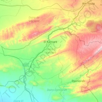
Name: El Kantara District topographic map, elevation, terrain.
Location: El Kantara District, Biskra, Algeria (35.08795 5.47100 35.28565 5.96611)
Average elevation: 2,316 ft
Minimum elevation: 666 ft
Maximum elevation: 5,768 ft
Other topographic maps
Click on a map to view its topography, its elevation and its terrain.