
Ibachirène topographic map
Interactive map
Click on the map to display elevation.
About this map
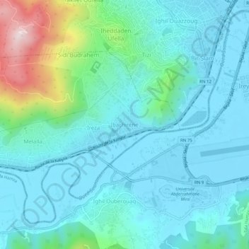
Name: Ibachirène topographic map, elevation, terrain.
Location: Ibachirène, Oued Ghir, Daïra Béjaïa, Béjaïa, 06120, Algérie (36.69523 5.02141 36.73523 5.06141)
Average elevation: 289 ft
Minimum elevation: -7 ft
Maximum elevation: 1,614 ft