
Thank you for supporting this site ❤️
Make a donation
Make a donation
Gear up for your next adventure:
As an Amazon Associate, this site earns from qualifying purchases at no extra cost to you.
Ugshapungo topographic map
Click on the map to display elevation.
Thank you for supporting this site ❤️
Make a donation
Make a donation
Gear up for your next adventure:
As an Amazon Associate, this site earns from qualifying purchases at no extra cost to you.
About this map
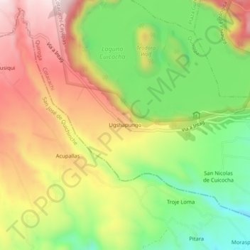
Name: Ugshapungo topographic map, elevation, terrain.
Location: Ugshapungo, Quiroga, Cotacachi, Imbabura, Ecuador (0.27096 -78.38894 0.31096 -78.34894)
Average elevation: 10,243 ft
Minimum elevation: 9,475 ft
Maximum elevation: 11,043 ft
Thank you for supporting this site ❤️
Make a donation
Make a donation
Gear up for your next adventure:
As an Amazon Associate, this site earns from qualifying purchases at no extra cost to you.