
Klein Hehlen topographic map
Interactive map
Click on the map to display elevation.
About this map
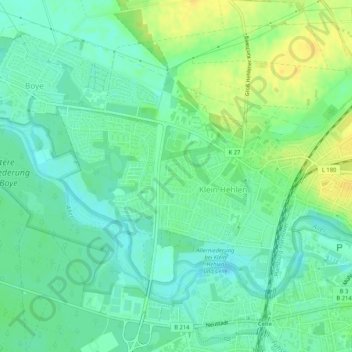
Name: Klein Hehlen topographic map, elevation, terrain.
Location: Klein Hehlen, Celle, Landkreis Celle, Lower Saxony, Germany (52.62240 10.02822 52.64444 10.08016)
Average elevation: 138 ft
Minimum elevation: 105 ft
Maximum elevation: 184 ft