Терскол topographic map
Interactive map
Click on the map to display elevation.
About this map
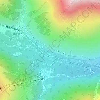
Name: Терскол topographic map, elevation, terrain.
Average elevation: 7,605 ft
Minimum elevation: 6,594 ft
Maximum elevation: 10,151 ft

Click on the map to display elevation.
Name: Терскол topographic map, elevation, terrain.
Average elevation: 7,605 ft
Minimum elevation: 6,594 ft
Maximum elevation: 10,151 ft