
Round Rock topographic map
Click on the map to display elevation.
Round Rock
The city straddles the Balcones Escarpment, a fault line in which the areas roughly east of Interstate 35 are flat and characterized by having black, fertile soils of the Blackland Prairie, and the west side of the Escarpment, which consists mostly of hilly, karst-like terrain with little topsoil and higher elevations and which is part of the Texas Hill Country. Located about 20 miles (32 km) north of downtown Austin, Round Rock shares a common border with Austin at Texas State Highway 45.
About this map
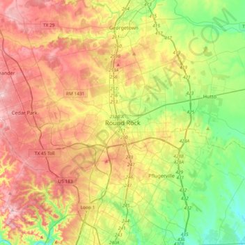
Name: Round Rock topographic map, elevation, terrain.
Location: Round Rock, Williamson County, Texas, 78680, United States (30.34859 -97.83881 30.66859 -97.51881)
Average elevation: 774 ft
Minimum elevation: 482 ft
Maximum elevation: 1,122 ft
Williamson County trails, hiking, mountain biking, running and outdoor activities