
L'Equipée topographic map
Interactive map
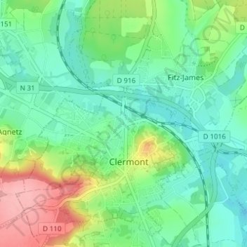
Click on the map to display elevation.
About this map
Name: L'Equipée topographic map, elevation, terrain.
Average elevation: 256 ft
Minimum elevation: 128 ft
Maximum elevation: 545 ft
Other topographic maps
Click on a map to view its topography, its elevation and its terrain.
La Croix de Creil
France > Hauts-de-France > Oise > Clermont
La Croix de Creil, Clermont, Oise, Hauts-de-France, France métropolitaine, 60600, France
Average elevation: 259 ft