Geolocate

Chornobyl topographic map

Click on the map to display elevation.

About this map
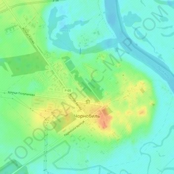
Name: Chornobyl topographic map, elevation, terrain.

Location: Chornobyl, Vyshhorod Raion, Kyiv Oblast, 07270, Ukraine (51.26105 30.19563 51.28992 30.24375)

Average elevation: 371 ft

Minimum elevation: 325 ft

Maximum elevation: 456 ft

Gear up for your next adventure:

🪶Wildlife Field Guides - Learn animal tracking and species ID
🏫Relief Map Kits - Hands-on tools for teaching landforms and elevation
🧤Hiking Gloves - Protective gloves for rugged trails
🧦Merino Wool Socks - Moisture-wicking, blister-preventing socks for long treks
⛺Backpacking Tent - Lightweight and durable tent for multi‑day hikes

As an Amazon Associate, this site earns from qualifying purchases at no extra cost to you.