
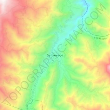
Samaniego topographic map
Interactive map
Click on the map to display elevation.
About this map
Name: Samaniego topographic map, elevation, terrain.
Location: Samaniego, Los Abades, Nariño, Colombie (1.29850 -77.63294 1.37850 -77.55294)
Average elevation: 6,371 ft
Minimum elevation: 4,026 ft
Maximum elevation: 9,446 ft