
Kijkuit topographic map
Interactive map
Click on the map to display elevation.
About this map
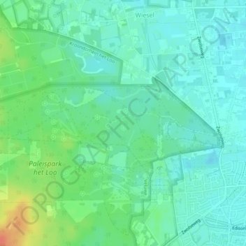
Name: Kijkuit topographic map, elevation, terrain.
Location: Kijkuit, Apeldoorn, Gelderland, Nederland, 7345CB, Nederland (52.24115 5.93891 52.24228 5.93951)
Average elevation: 79 ft
Minimum elevation: 36 ft
Maximum elevation: 177 ft
Other topographic maps
Click on a map to view its topography, its elevation and its terrain.
Paleis het Loo
Nederland > Gelderland > Apeldoorn
Paleis het Loo, Achterstoep, Apeldoorn, Gelderland, Nederland, 7315 JA, Nederland
Average elevation: 72 ft
Torenberg
Nederland > Gelderland > Apeldoorn
Torenberg, Apeldoorn, Gelderland, Nederland, 7346AA, Nederland
Average elevation: 305 ft