
المخيبة الفوقة topographic map
Interactive map
Click on the map to display elevation.
About this map
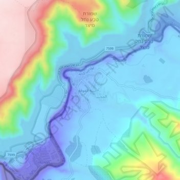
Name: المخيبة الفوقة topographic map, elevation, terrain.
Average elevation: 118 ft
Minimum elevation: -587 ft
Maximum elevation: 1,168 ft
Other topographic maps
Click on a map to view its topography, its elevation and its terrain.
Umm Qais
Jordan > Irbid > Bani Kenanah Sub-District
Umm Qais, Bani Kenanah Sub-District, Bani Kenanah District, Irbid, Jordan
Average elevation: 715 ft
حريما
Jordan > Irbid > Bani Kenanah Sub-District
حريما, Bani Kenanah Sub-District, Bani Kenanah District, Irbid, 21124, Jordan
Average elevation: 1,667 ft