
Inverness topographic map
Interactive map
Click on the map to display elevation.
About this map
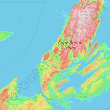
Name: Inverness topographic map, elevation, terrain.
Location: Inverness, Inverness County, Nouvelle-Écosse, Canada (45.46819 -61.91974 46.86819 -60.51974)
Average elevation: 253 ft
Minimum elevation: -10 ft
Maximum elevation: 1,742 ft