Pinto Lake topographic map
Interactive map
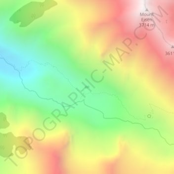
Click on the map to display elevation.
About this map
Name: Pinto Lake topographic map, elevation, terrain.
Average elevation: 9,721 ft
Minimum elevation: 7,631 ft
Maximum elevation: 12,080 ft

Click on the map to display elevation.
Name: Pinto Lake topographic map, elevation, terrain.
Average elevation: 9,721 ft
Minimum elevation: 7,631 ft
Maximum elevation: 12,080 ft