
Río Salado topographic map
Interactive map
Click on the map to display elevation.
About this map
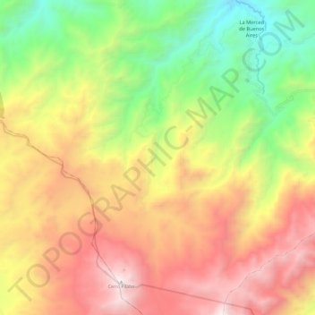
Name: Río Salado topographic map, elevation, terrain.
Location: Río Salado, San Miguel de Urcuquí, Imbabura, Ecuador (0.50979 -78.35466 0.62793 -78.32348)
Average elevation: 10,243 ft
Minimum elevation: 6,736 ft
Maximum elevation: 13,871 ft
Other topographic maps
Click on a map to view its topography, its elevation and its terrain.
Río Amarillo
Río Amarillo, San Miguel de Urcuquí, Imbabura, Ecuador
Average elevation: 3,907 ft