
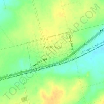
Westbrook topographic map
Interactive map
Click on the map to display elevation.
About this map
Name: Westbrook topographic map, elevation, terrain.
Average elevation: 2,156 ft
Minimum elevation: 2,106 ft
Maximum elevation: 2,195 ft
Other topographic maps
Click on a map to view its topography, its elevation and its terrain.
Westbrook
États-Unis d'Amérique > Texas > Mitchell County
Westbrook, Mitchell County, Texas, 79565, États-Unis d'Amérique
Average elevation: 2,156 ft
Westbrook
États-Unis d'Amérique > Texas > Mitchell County > Westbrook > Westbrook
Westbrook, Mitchell County, Texas, 79565, États-Unis d'Amérique
Average elevation: 2,152 ft