
Fuente la Lancha topographic map
Interactive map
Click on the map to display elevation.
About this map
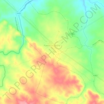
Name: Fuente la Lancha topographic map, elevation, terrain.
Location: Fuente la Lancha, Córdova, Andaluzia, Espanha (38.39743 -5.06750 38.44181 -5.03006)
Average elevation: 1,804 ft
Minimum elevation: 1,631 ft
Maximum elevation: 1,991 ft