
GMHütte topographic map
Interactive map
Click on the map to display elevation.
About this map
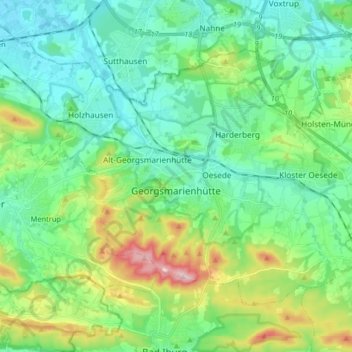
Name: GMHütte topographic map, elevation, terrain.
Location: GMHütte, Landkreis Osnabrück, Nedersaksen, 49124, Duitsland (52.16769 7.98955 52.24023 8.15181)
Average elevation: 436 ft
Minimum elevation: 220 ft
Maximum elevation: 1,070 ft