
Lake Karangata topographic map
Interactive map
Click on the map to display elevation.
About this map
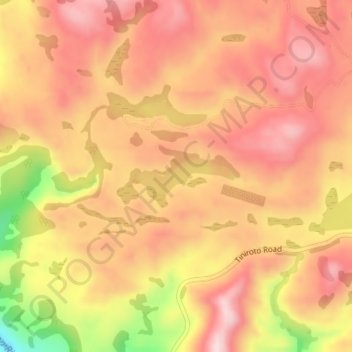
Name: Lake Karangata topographic map, elevation, terrain.
Location: Lake Karangata, Berry Road, Gisborne, New Zealand (-38.77432 177.53798 -38.77149 177.54760)
Average elevation: 886 ft
Minimum elevation: 246 ft
Maximum elevation: 1,201 ft
Other topographic maps
Click on a map to view its topography, its elevation and its terrain.
Hangaroa River
Hangaroa River, Gisborne, New Zealand
Average elevation: 1,266 ft
Pourewa Island
Pourewa Island, Gisborne, 4046, New Zealand
Average elevation: 354 ft
Waiomoko River
Waiomoko River, Gisborne, 4073, New Zealand
Average elevation: 112 ft
Mangaheia River
Mangaheia River, Gisborne, 4046, New Zealand
Average elevation: 46 ft
Waipaoa River
Waipaoa River, Gisborne, 4071, New Zealand
Average elevation: 584 ft