
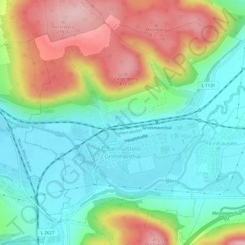
Obermaßfeld-Grimmenthal topographic map
Interactive map
Click on the map to display elevation.
About this map
Name: Obermaßfeld-Grimmenthal topographic map, elevation, terrain.
Average elevation: 1,184 ft
Minimum elevation: 951 ft
Maximum elevation: 1,594 ft
Other topographic maps
Click on a map to view its topography, its elevation and its terrain.
Birx
Duitsland > Thüringen > Landkreis Schmalkalden-Meiningen
Birx, Hohe Rhön, Landkreis Schmalkalden-Meiningen, Thüringen, Duitsland
Average elevation: 2,379 ft
Christes
Duitsland > Thüringen > Landkreis Schmalkalden-Meiningen
Christes, Dolmar-Salzbrücke, Landkreis Schmalkalden-Meiningen, Thüringen, Duitsland
Average elevation: 1,594 ft
Oberhof
Duitsland > Thüringen > Landkreis Schmalkalden-Meiningen
Oberhof, Landkreis Schmalkalden-Meiningen, Thüringen, 98559, Duitsland
Average elevation: 2,457 ft