Geolocate

Lakrishtë topographic map

Click on the map to display elevation.

About this map

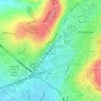
Name: Lakrishtë topographic map, elevation, terrain.

Location: Lakrishtë, Pristina, Municipality of Pristina, Kosovo (42.65263 21.14591 42.66524 21.16068)

Average elevation: 1,978 ft

Minimum elevation: 1,867 ft

Maximum elevation: 2,162 ft

Other topographic maps

Click on a map to view its topography, its elevation and its terrain.

Pristina

Kosovo > Municipality of Pristina > Pristina

Average elevation: 2,280 ft

Gear up for your next adventure:

🪶Camping Sleeping Pad - Comfortable sleeping pad for backpacking
😴Insulated Sleeping Pads - Compact and warm pads for high-elevation camping
🚗GPS Dash Cams - Record your scenic drives through mountain passes and canyons
📶Vehicle Signal Boosters - Improve reception in rural areas while driving to trailheads
🏕️Tent Footprint - Protect your tent base from wear

As an Amazon Associate, this site earns from qualifying purchases at no extra cost to you.