
Nador topographic map
Interactive map
Click on the map to display elevation.
About this map
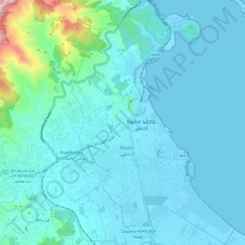
Name: Nador topographic map, elevation, terrain.
Location: Nador, Pachalik de Nador, Province de Nador, Oriental, Maroc (35.12586 -2.96271 35.22395 -2.88228)
Average elevation: 223 ft
Minimum elevation: -7 ft
Maximum elevation: 2,175 ft