
Make a donation
Gear up for your next adventure:
As an Amazon Associate, this site earns from qualifying purchases at no extra cost to you.
Clear Lake topographic map
Click on the map to display elevation.
Make a donation
Gear up for your next adventure:
As an Amazon Associate, this site earns from qualifying purchases at no extra cost to you.
About this map
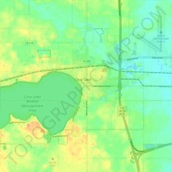
Name: Clear Lake topographic map, elevation, terrain.
Location: Clear Lake, Cerro Gordo County, Iowa, 50428, United States (43.10469 -93.43827 43.16273 -93.32001)
Average elevation: 1,224 ft
Minimum elevation: 1,171 ft
Maximum elevation: 1,306 ft
Cerro Gordo County trails, hiking, mountain biking, running and outdoor activities
Make a donation
Gear up for your next adventure:
As an Amazon Associate, this site earns from qualifying purchases at no extra cost to you.
Other topographic maps
Click on a map to view its topography, its elevation and its terrain.
Clear Lake
United States > Iowa > Cerro Gordo County > Clear Lake > Clear Lake
Average elevation: 1,224 ft