
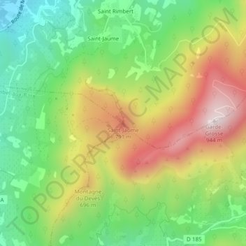
Saint-Jaume topographic map
Interactive map
Click on the map to display elevation.
About this map
Name: Saint-Jaume topographic map, elevation, terrain.
Average elevation: 1,772 ft
Minimum elevation: 807 ft
Maximum elevation: 3,051 ft
Other topographic maps
Click on a map to view its topography, its elevation and its terrain.
Les Rieux
France > Auvergne-Rhône-Alpes > Drôme > Nyons
Les Rieux, Nyons, Drôme, Auvergne-Rhône-Alpes, France métropolitaine, 26110, France
Average elevation: 1,424 ft
Les Clots
France > Auvergne-Rhône-Alpes > Drôme > Nyons
Les Clots, Nyons, Drôme, Auvergne-Rhône-Alpes, France métropolitaine, 26110, France
Average elevation: 1,378 ft
Saint Rimbert
France > Auvergne-Rhône-Alpes > Drôme > Nyons
Saint Rimbert, Nyons, Drôme, Auvergne-Rhône-Alpes, France métropolitaine, 26110, France
Average elevation: 1,447 ft