
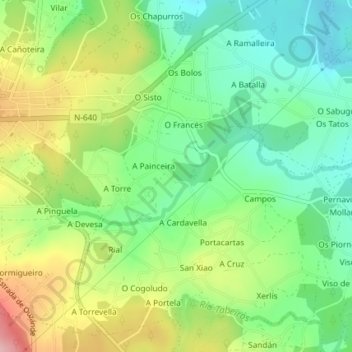
Guimarei topographic map
Interactive map
Click on the map to display elevation.
About this map
Name: Guimarei topographic map, elevation, terrain.
Average elevation: 794 ft
Minimum elevation: 574 ft
Maximum elevation: 1,145 ft
Other topographic maps
Click on a map to view its topography, its elevation and its terrain.
Forcarei
España > Galicia > Tabeirós - Tierra de Montes > Forcarei
Forcarei, Tabeirós - Tierra de Montes, Pontevedra, Galicia, 36550, España
Average elevation: 1,900 ft