
Gombe topographic map
Interactive map
Click on the map to display elevation.
About this map
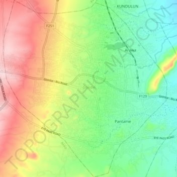
Name: Gombe topographic map, elevation, terrain.
Location: Gombe, Gombe State, Nigeria (10.23905 11.12125 10.32399 11.20115)
Average elevation: 1,594 ft
Minimum elevation: 1,257 ft
Maximum elevation: 2,087 ft
Located at an elevation of 451.61 meters (1481.66 feet) above sea level, Gombe has a Tropical wet and dry or savanna climate (Classification: Aw). The city's yearly temperature is 30.54 °C (86.97 °F) and it is 1.08% higher than Nigeria's averages.
Other topographic maps
Click on a map to view its topography, its elevation and its terrain.