
Sedam taluku topographic map
Interactive map
Click on the map to display elevation.
About this map
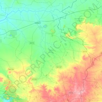
Name: Sedam taluku topographic map, elevation, terrain.
Location: Sedam taluku, Kalaburagi district, Karnataka, India (16.87148 77.11022 17.26529 77.50320)
Average elevation: 1,617 ft
Minimum elevation: 1,293 ft
Maximum elevation: 2,333 ft
Other topographic maps
Click on a map to view its topography, its elevation and its terrain.
Hanumanahalli
India > Karnataka > Sedam taluku > Hanumanahalli
Hanumanahalli, Sedam taluku, Kalaburagi district, Karnataka, India
Average elevation: 1,440 ft