
Río Frío topographic map
Interactive map
Click on the map to display elevation.
About this map
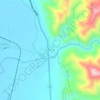
Name: Río Frío topographic map, elevation, terrain.
Location: Río Frío, Zona Bananera (Prado Sevilla), Magdalena, Colombia (10.88279 -74.17312 10.92279 -74.13312)
Average elevation: 394 ft
Minimum elevation: 39 ft
Maximum elevation: 1,732 ft