
Macieira topographic map
Interactive map
Click on the map to display elevation.
About this map
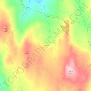
Name: Macieira topographic map, elevation, terrain.
Average elevation: 2,598 ft
Minimum elevation: 1,995 ft
Maximum elevation: 3,104 ft
Other topographic maps
Click on a map to view its topography, its elevation and its terrain.
Ferreirim
Portugal > Viseu > Ferreirim e Macieira
Ferreirim, Ferreirim e Macieira, Sernancelhe, Viseu, 3640-110, Portugal
Average elevation: 2,188 ft