
Achleithen topographic map
Interactive map
Click on the map to display elevation.
About this map
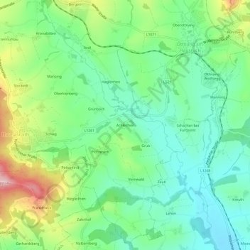
Name: Achleithen topographic map, elevation, terrain.
Average elevation: 1,762 ft
Minimum elevation: 1,526 ft
Maximum elevation: 2,254 ft
Other topographic maps
Click on a map to view its topography, its elevation and its terrain.
Redl
Österreich > Oberösterreich > Bezirk Vöcklabruck > Ottnang am Hausruck
Redl, Ottnang am Hausruck, Bezirk Vöcklabruck, Oberösterreich, 4901, Österreich
Average elevation: 1,854 ft