
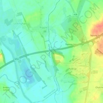
Ripple Brook topographic map
Interactive map
Click on the map to display elevation.
About this map
Name: Ripple Brook topographic map, elevation, terrain.
Average elevation: 66 ft
Minimum elevation: 13 ft
Maximum elevation: 167 ft
Other topographic maps
Click on a map to view its topography, its elevation and its terrain.
Tewkesbury
Vereinigtes Königreich > England > Gloucestershire > Tewkesbury
Tewkesbury, Gloucestershire, England, Vereinigtes Königreich
Average elevation: 59 ft