Geolocate

Capua topographic map

Click on the map to display elevation.

About this map

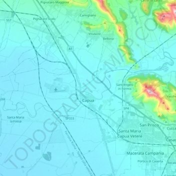
Name: Capua topographic map, elevation, terrain.

Location: Capua, Caserta, Campania, Italy (41.08778 14.12198 41.14867 14.31925)

Average elevation: 180 ft

Minimum elevation: 23 ft

Maximum elevation: 1,926 ft

Other topographic maps

Click on a map to view its topography, its elevation and its terrain.

Cappelle

Italy > Campania > Caserta > Teano

Average elevation: 997 ft

Località Aurno

Italy > Campania > Caserta > Marcianise

Average elevation: 72 ft

Ventaroli

Italy > Campania > Caserta > Carinola

Average elevation: 512 ft

Talanico

Italy > Campania > Caserta > San Felice a Cancello

Average elevation: 1,010 ft

Destra Volturno

Italy > Campania > Caserta > Castel Volturno

Average elevation: 3 ft

San Leucio-complex

Italy > Campania > Caserta > Caserta

Average elevation: 558 ft

Brezza

Italy > Campania > Caserta

Average elevation: 43 ft

Brezza

Italy > Campania > Caserta

Average elevation: 43 ft

Campo Felice

Italy > Campania > Caserta > Cellole

Average elevation: 30 ft

Gear up for your next adventure:

📚Navigation Handbooks - Master the art of reading topographic maps and using a compass
GPS Sports Watch - GPS watch for running, hiking and training
🪶Fire Starter Kit - Reliable fire starter for survival and camping
🧭Outdoor Navigation Book - Learn advanced navigation skills
🎒Hydration Pack - Hands‑free water reservoir for long hikes

As an Amazon Associate, this site earns from qualifying purchases at no extra cost to you.