
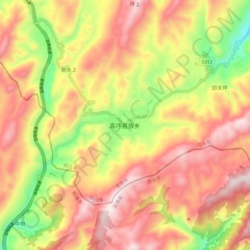
高坪苗族乡 topographic map
Interactive map
Click on the map to display elevation.
About this map
Name: 高坪苗族乡 topographic map, elevation, terrain.
Location: 高坪苗族乡, 筠连县, 宜宾市, 四川省, 中国 (27.82927 104.54309 27.90927 104.62309)
Average elevation: 4,098 ft
Minimum elevation: 2,717 ft
Maximum elevation: 5,174 ft