Geolocate

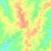
Stem topographic map

Click on the map to display elevation.

About this map

Name: Stem topographic map, elevation, terrain.

Location: Stem, Granville County, North Carolina, 27581, United States (36.17874 -78.74414 36.21018 -78.70362)

Average elevation: 436 ft

Minimum elevation: 305 ft

Maximum elevation: 518 ft

Granville County trails, hiking, mountain biking, running and outdoor activities

Other topographic maps

Click on a map to view its topography, its elevation and its terrain.

Berea

United States > North Carolina > Granville County

Average elevation: 482 ft

Oxford

United States > North Carolina > Granville County > Oxford > Oxford

Average elevation: 469 ft

Wilton

United States > North Carolina > Granville County

Average elevation: 407 ft

Gear up for your next adventure:

👓Polarized Sunglasses - Outdoor sunglasses for glare reduction
📚USA Hiking Guide Books - Top trail guides and map books
🌲Outdoor Survival Books - Best books on survival skills
🔭Telescopic Hiking Pole - Adjustable pole for hiking stability
🕶️GPS Smartphone Mount - Secure mount for phone navigation

As an Amazon Associate, this site earns from qualifying purchases at no extra cost to you.