
Trawas topographic map
Interactive map
Click on the map to display elevation.
About this map
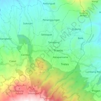
Name: Trawas topographic map, elevation, terrain.
Location: Trawas, Mojokerto, East Java, Indonesia (-7.70483 112.55632 -7.62483 112.63632)
Average elevation: 2,644 ft
Minimum elevation: 1,306 ft
Maximum elevation: 5,994 ft