
Allanton topographic map
Interactive map
Click on the map to display elevation.
About this map
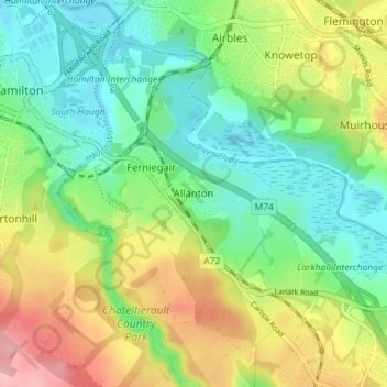
Name: Allanton topographic map, elevation, terrain.
Location: Allanton, South Lanarkshire, Scotland, ML3 7TY, United Kingdom (55.74524 -4.02100 55.78524 -3.98100)
Average elevation: 217 ft
Minimum elevation: 66 ft
Maximum elevation: 472 ft