
Kallat El Andalous topographic map
Interactive map
Click on the map to display elevation.
About this map
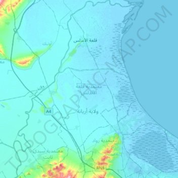
Name: Kallat El Andalous topographic map, elevation, terrain.
Location: Kallat El Andalous, Ariana, 2022, Tunisie (36.87904 10.03095 37.11516 10.21469)
Average elevation: 43 ft
Minimum elevation: -23 ft
Maximum elevation: 846 ft
Other topographic maps
Click on a map to view its topography, its elevation and its terrain.