
Shapingba District topographic map
Interactive map
Click on the map to display elevation.
About this map
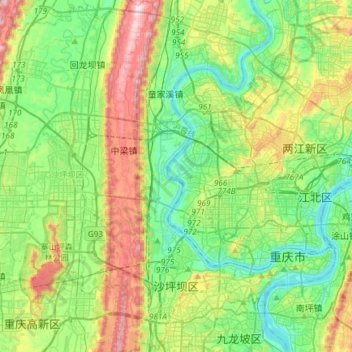
Name: Shapingba District topographic map, elevation, terrain.
Location: Shapingba District, Chongqing, PRC (29.49450 106.24608 29.75347 106.49082)
Average elevation: 1,096 ft
Minimum elevation: 492 ft
Maximum elevation: 2,283 ft
Other topographic maps
Click on a map to view its topography, its elevation and its terrain.