
Kindu topographic map
Interactive map
Click on the map to display elevation.
About this map
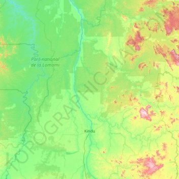
Name: Kindu topographic map, elevation, terrain.
Location: Kindu, Maniema, 00000, Democratic Republic of the Congo (-3.37547 24.47079 -1.40375 26.94059)
Average elevation: 1,739 ft
Minimum elevation: 1,365 ft
Maximum elevation: 3,904 ft