
Lum topographic map
Interactive map
Click on the map to display elevation.
About this map
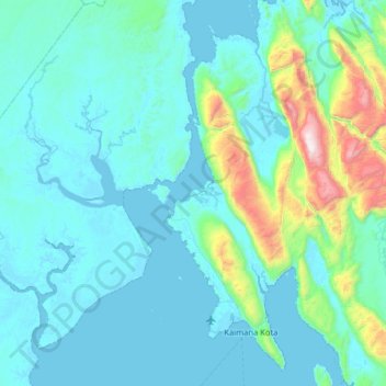
Name: Lum topographic map, elevation, terrain.
Location: Lum, Pabar, Indonesia (-3.75333 133.34667 -3.11333 133.98667)
Average elevation: 600 ft
Minimum elevation: -20 ft
Maximum elevation: 5,322 ft
Other topographic maps
Click on a map to view its topography, its elevation and its terrain.
Pulau Salawati
Pulau Salawati, Sorong, Pabar, Indonesia
Average elevation: 141 ft