
Rhyd-ddu topographic map
Interactive map
Click on the map to display elevation.
About this map
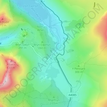
Name: Rhyd-ddu topographic map, elevation, terrain.
Average elevation: 951 ft
Minimum elevation: 443 ft
Maximum elevation: 2,238 ft
Other topographic maps
Click on a map to view its topography, its elevation and its terrain.
Afon Gwyrfai
United Kingdom > Wales > Gwynedd > Rhyd-ddu
Afon Gwyrfai, Rhyd-ddu, Betws Garmon, Gwynedd, Wales, LL54 6TL, United Kingdom
Average elevation: 814 ft