
Rio Negro topographic map
Interactive map
Click on the map to display elevation.
About this map
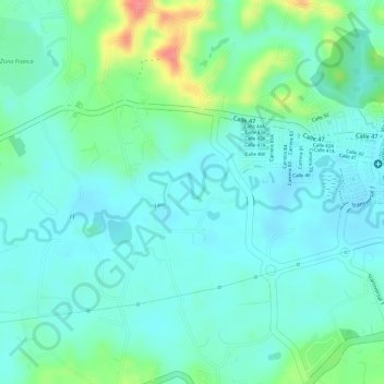
Name: Rio Negro topographic map, elevation, terrain.
Location: Rio Negro, Rionegro, Oriente, Antioquia, 054040, Colombia (6.14505 -75.40791 6.14875 -75.39839)
Average elevation: 6,890 ft
Minimum elevation: 6,821 ft
Maximum elevation: 7,077 ft
Other topographic maps
Click on a map to view its topography, its elevation and its terrain.
Santa Teresa
Colombia > Antioquia > Rionegro > Santa Teresa
Santa Teresa, Rionegro, Oriente, Antioquia, 054037, Colombia
Average elevation: 7,123 ft