Geolocate

Surry topographic map

Click on the map to display elevation.

About this map

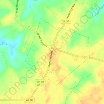
Name: Surry topographic map, elevation, terrain.

Location: Surry, Surry County, Virginia, United States (37.12837 -76.84376 37.14584 -76.82276)

Average elevation: 105 ft

Minimum elevation: 43 ft

Maximum elevation: 141 ft

Surry County trails, hiking, mountain biking, running and outdoor activities

Gear up for your next adventure:

🦶Carbon Trekking Poles - Reduce knee impact on steep descents with ultra-light poles
🎒Outdoor Daypacks - Lightweight backpacks designed for carrying maps and essential gear
🗺️Topographic Maps - Detailed topo maps for hiking, exploring and outdoor navigation
🥾Hiking Shoes - Durable and comfortable shoes for trail hiking
🦟Ultrasonic Repellers - Create a bug-free zone at your camp or rest stop

As an Amazon Associate, this site earns from qualifying purchases at no extra cost to you.