
London Borough of Southwark topographic map
Interactive map
Click on the map to display elevation.
About this map
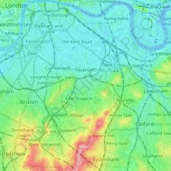
Name: London Borough of Southwark topographic map, elevation, terrain.
Average elevation: 82 ft
Minimum elevation: -16 ft
Maximum elevation: 371 ft
Other topographic maps
Click on a map to view its topography, its elevation and its terrain.
Sydenham Hill
United Kingdom > England > Greater London > London Borough of Southwark
Sydenham Hill, London Borough of Southwark, Greater London, England, SE26 6RS, United Kingdom
Average elevation: 217 ft