
Thank you for supporting this site ❤️
Make a donation
Make a donation
Gear up for your next adventure:
As an Amazon Associate, this site earns from qualifying purchases at no extra cost to you.
Zumbahua topographic map
Click on the map to display elevation.
Thank you for supporting this site ❤️
Make a donation
Make a donation
Gear up for your next adventure:
As an Amazon Associate, this site earns from qualifying purchases at no extra cost to you.
About this map
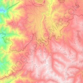
Name: Zumbahua topographic map, elevation, terrain.
Location: Zumbahua, Pujilí, Cotopaxi, Ecuador (-1.07086 -78.99333 -0.86019 -78.80796)
Average elevation: 12,208 ft
Minimum elevation: 7,136 ft
Maximum elevation: 14,820 ft
Thank you for supporting this site ❤️
Make a donation
Make a donation
Gear up for your next adventure:
As an Amazon Associate, this site earns from qualifying purchases at no extra cost to you.