
Oberbüren topographic map
Interactive map
Click on the map to display elevation.
About this map
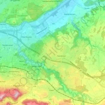
Name: Oberbüren topographic map, elevation, terrain.
Location: Oberbüren, Wahlkreis Wil, Sankt Gallen, Schweiz (47.41063 9.11927 47.46953 9.22431)
Average elevation: 1,909 ft
Minimum elevation: 1,555 ft
Maximum elevation: 2,598 ft