
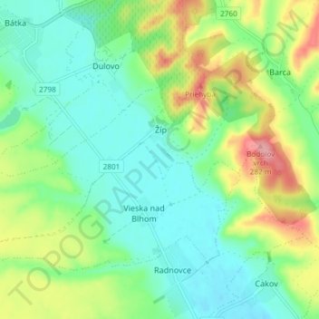
Žíp topographic map
Interactive map
Click on the map to display elevation.
About this map
Name: Žíp topographic map, elevation, terrain.
Average elevation: 659 ft
Minimum elevation: 541 ft
Maximum elevation: 902 ft
Other topographic maps
Click on a map to view its topography, its elevation and its terrain.
Belín
Slovakia > Region of Banská Bystrica > District of Rimavská Sobota
Belín, District of Rimavská Sobota, Region of Banská Bystrica, Central Slovakia, Slovakia
Average elevation: 771 ft
Babinec
Slovakia > Region of Banská Bystrica > District of Rimavská Sobota > Babinec
Babinec, District of Rimavská Sobota, Region of Banská Bystrica, Central Slovakia, Slovakia
Average elevation: 1,434 ft
Rimavská Sobota
Slovakia > Region of Banská Bystrica > District of Rimavská Sobota
Rimavská Sobota, District of Rimavská Sobota, Region of Banská Bystrica, Central Slovakia, 979 01, Slovakia
Average elevation: 856 ft