
Hidoussa topographic map
Interactive map
Click on the map to display elevation.
About this map
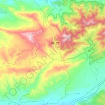
Name: Hidoussa topographic map, elevation, terrain.
Location: Hidoussa, Daïra Merouana, Batna, RADP (35.42834 5.84054 35.62862 5.99734)
Average elevation: 4,528 ft
Minimum elevation: 3,209 ft
Maximum elevation: 7,080 ft