
Cheti topographic map
Interactive map
Click on the map to display elevation.
About this map
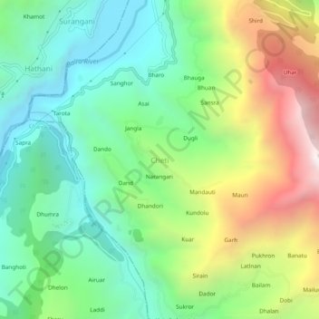
Name: Cheti topographic map, elevation, terrain.
Location: Cheti, Chaurah, Chamba, Himachal Pradesh, 176317, India (32.68853 76.08258 32.72853 76.12258)
Average elevation: 4,344 ft
Minimum elevation: 2,612 ft
Maximum elevation: 7,566 ft