
St. Peter - San Pietro topographic map
Interactive map
Click on the map to display elevation.
About this map
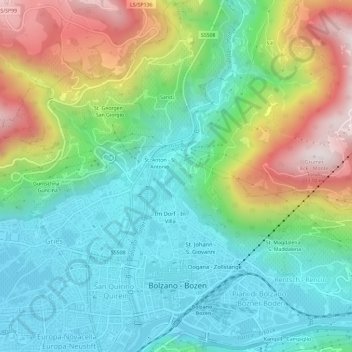
Name: St. Peter - San Pietro topographic map, elevation, terrain.
Average elevation: 1,713 ft
Minimum elevation: 810 ft
Maximum elevation: 3,599 ft
Other topographic maps
Click on a map to view its topography, its elevation and its terrain.
Rentsch
Italy > Trentino-Alto Adige/Südtirol > South Tyrol > Bolzano - Bozen
Rentsch, Bolzano - Bozen, South Tyrol, Trentino-Alto Adige/Südtirol, 39190, Italy
Average elevation: 1,808 ft